Tiong Bahru, a Thought on Heritage

Standard

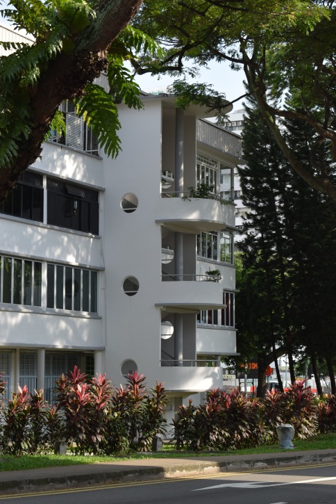
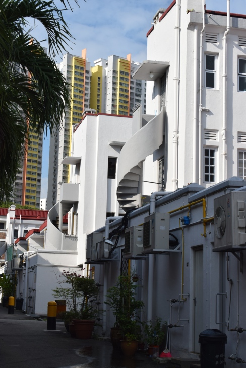
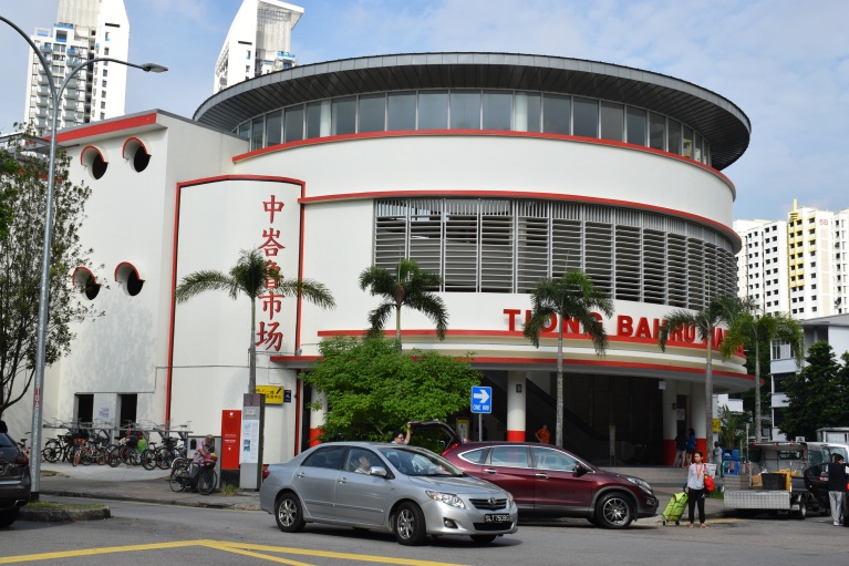
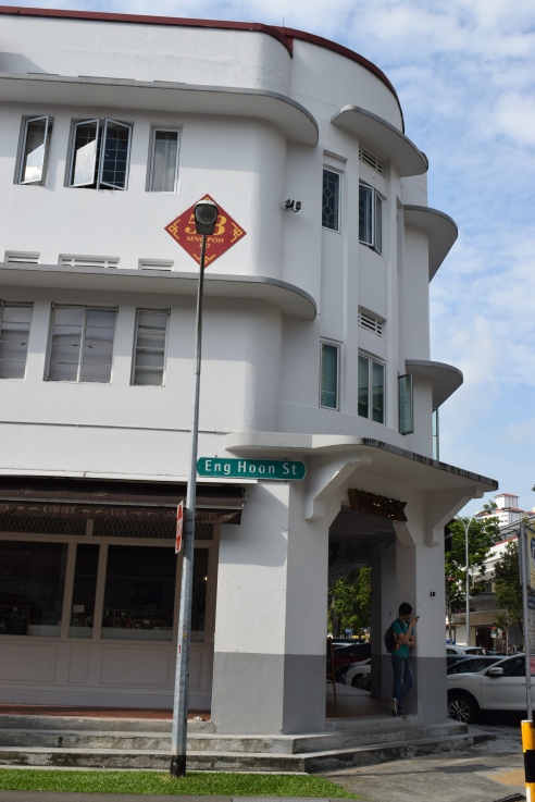
Singapore’s first public housing project surprisingly retains the textures of the then emerging international style and Art Deco movements in architecture. Tiong Bahru is a true heritage spot and an exceptional example of a planned urban space that is still glossed over by most who visit this bustling city in a garden.

DSC_0442

There are two reasons that I can think of for this:  the area hardly makes it to guidebooks, which sadly reflects the truth that what gets written in the pages are simply those that the writers just want others to see and know and there have been cases that they do NOT really know enough; and, more importantly, modern architectural movements still rarely appeal to many in ways colonial Straits shophouses do, as in the cases of Chinatown, Kampong Glam or Little India. It seems that the lack of “romance” and “ancientness” around the former hinder the interest of the average person towards them.

DSC_0444

DSC_0440

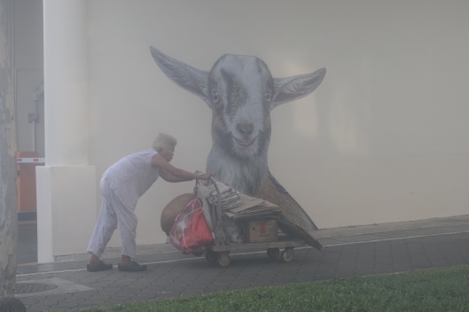
In an advanced city now known for its modern marvels, how much attention and appreciation can really be accorded to the last remaining built-heritage around? It seems that turn of the 20th-century architecture suffers the most undervaluation and apathy, and Tiong Bahru’s case illustrates this phenomenon clearly.

DSC_0429

DSC_0439

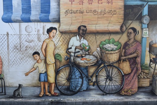
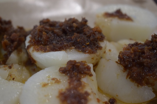
But how did I get there, to begin with? A friend took me there primarily for the food offering in Tiong Bahru market — which is amazing! The buildings were really a big surprise to me as I did not know anything about them beforehand.

DSC_0433


The Defenses of Currimao

Standard

Ever since I was a kid, Currimao in Ilocos Norte has always had a special place in my heart. It has decent packets of beaches very close to where I live, making it an easy weekend getaway. Pangil, one of its barangays, offers what I would describe as the site of the most romantic sunset one can witness in the north thanks to its dramatic rocky landscape. It’s very easy to fall in love with it. Aside from this, however, I did not know anything else about this small, sleepy town by the sea.

Well, until recently[1].

A Reminder of the Tobacco Trade

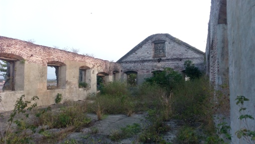
During the Spanish period, Currimao, which was still a  part of Paoay, was a commercial port that played an important role in the tobacco trade. The northern Philippines was then known to have focused on this cash crop, supplying not only local demands but even those from overseas. The town has an 1869-built almacen, popularly known today as the tabacalera, which was used by the Compania General de los Tabacos de Filipinas. There are two other extant tabacaleras in the province, one in Laoag[2] and another in Dingras. But, what makes Currimao’s tabacalera special is that it was at the forefront of the trade given its strategic location and access to the open waters.
IMG_20160314_173944

Inside the tabacalera ruins

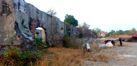
The massive structure follows a simple rectangular floor plan, with all sides supported by identical buttresses reminiscent of earthquake baroque churches. It also has gabled ends and what appears to be a portico on the main portal. Vestiges of an old perimeter wall made of the same materials used in constructing the almacen – rocks, coral stones and ladrillos – can be found around it as well.
IMG_20160314_193544_720

Exterior of the tabacalera with its buttresses, and the mess around it.

Given its already fragile condition, what is more disturbing, however, is the obvious neglect of the site by the locals. Currently, it is used as a heavy equipment and motor pool, as well as a dump site for gravel and aggregates for construction works. This is alarming because its state of disrepair might jeopardize the ongoing process to designate the site yet another National Cultural Treasure – a procedure to be completed, hopefully, by next year[3].

The almacen sits just a few meters away from an old yet still functioning pantalan or wharf that is made of coral stones[4]. This, however, was cemented with concrete a few years ago giving a very modern appearance to it nowadays. Also, close to the almacen, to its left, is another ruins of what might have been the aduana or the customs office[5]. Presently, the remains of this brick edifice is within a private property and no one really knows  what will happen to it nor can anyone guarantee its preservation. Furthermore, a few meters again from the ruins is an agua del pozo[6] or a water well. Aside from it still being used, what is more impressive about this simple structure is that it is dated: 12 de Diciembre de 1878 ano.
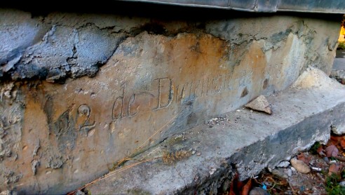
IMG_20160314_190645_984

The Spanish period well with the date of its construction

Man-made Fortifications

Across the archipelago, there are hundreds of watchtowers and fortresses built by the Spaniards in their attempt to fortify their empire in the Pacific[7]. Ilocos Norte alone has six, and neighboring Ilocos Sur has five. The existence of a twin watchtowers or garitas only reinforces the historical – and commercial – importance of Currimao as a port. In the Philippines, I am only aware of one other town where a twin watchtowers also exist: Romblon, Romblon[8]. Furthermore, the twin watchtowers of Romblon and Currimao have another striking resemblance: their fortifications can be found at either ends of their poblacion harbour. Their only difference is that, for Romblon, the watchtowers were meant to guard over the pueblo with a church, while Currimao’s were meant to watch over a coastal settlement with a tabacalera.
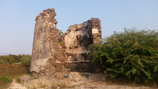
IMG_20160314_171610

The eastern watchtower

The more obvious of the two watchtowers in Currimao is partly damaged as a segment of its wall has already collapsed. This one is noticeable at any point along the seawall as it prominently stands at the eastern end of the harbour, without any obstruction surrounding it[9]. The other watchtower, which is still complete, is currently heavily vegetated. Several concrete structures have also already been built around it, thus compromising its visual integrity[10]. Both of these watchtowers, which stand approximately seven meters high, are thought to have been built in the mid 1800s or even much earlier.
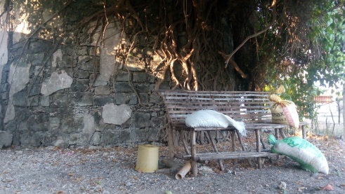
IMG_20160314_164926

The western watchtower

Despite having been declared as National Cultural Treasures in 2015 under the serial inscription “Watchtowers of Ilocos Norte”[11], there is still the urgent need to conserve and restore the structures that are clearly under threats caused by human negligence and natural disasters.

The Coral Rocks as Natural Barriers

Currimao also boasts a unique landscape and seascape. It is home to a very long coral rock formation along its coast. The entire length of this geological curiosity spans nearly three kilometers, and the best exponents of it are found in Barangay Pangil.
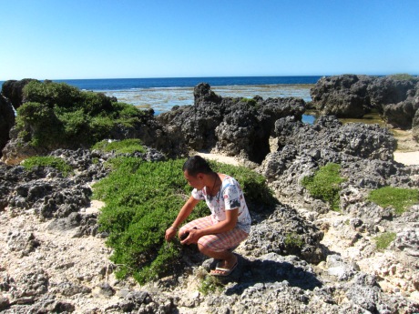
IMG_0407

The sharp coral cocks make it impossible for boats and ships to get any closer than 100 metres to shore.

What many might not realize, however, is that these sharp ancient rocks form a durable wall, which creates a natural fortification for the community. During the time when the tobacco trade was at its peak (as a component of the Galleon trade), threats from invading Moros and Chinese pirates were very common in the area. This is also the reason why the watchtowers have come to be known locally as the Moro watchtowers. But, given its rocky shores, boats, let alone ships, cannot dock just anywhere; the rocks and waves make that impossible. Hence, anyone who wished to make a landing would have to go to the only area devoid of coral rocks – the poblacion harbour.
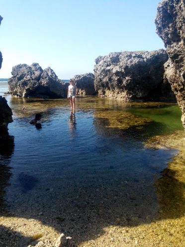
The coral rocks in Pangil can reach as high as four meters tall.

The coral rocks can rise as high as four meters above the water line.

Until now, it is only this particular area where fishermen can safely dock their fishing boats and rafts (with the exception, of course, of the more sandy shores of Victoria and Gaang that are already far away from the poblacion). The Spaniards erected the watchtowers precisely where the natural fortifications ceased.

Fortified Commercial Complex?

A good fortification utilizes elements in its surroundings to its advantage. The coral rocks and the watchtowers complemented each other in as far as guarding Currimao and its commercial activities were concerned. This outstanding system of natural barriers and man-made fortifications made the poblacion of Currimao a highly defensive coastal settlement by Philippine standards at that time. With the presence of the ruins of an almacen and an aduana, a functioning agua del pozo and pantalan, as well as two garitas, together with its imposing long coral rock formations, it is only fitting to reassess, rethink, and reintroduce the poblacion of Currimao – yes, the small, sleepy town – as an intact, fortified, Spanish-period commercial complex that might be hard to match elsewhere in the country.
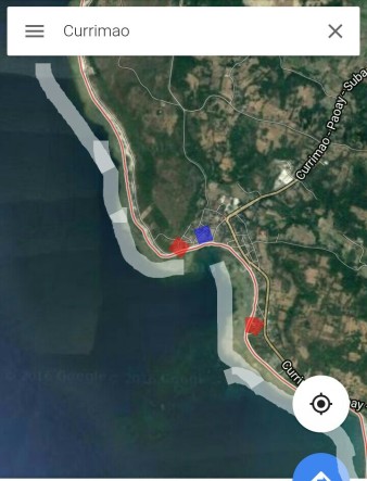
IMG_20160803_024646_967

Legend: Blue – location of the almacen, aduana, pozo del agua, and pantalan; red – the two garitas declared as National Cultural Treasures; grey – the coastal areas with coral rocks.


___________________________

[1] Performed cultural mapping and documentation in town on March 14, 2016 for www.philippineheritagemap.org

[2] Presently housing the Ilocos Norte Museum

[3]“Pending cultural properties for consideration for declaration as Important Cultural Properties or National Cultural Treasures by the National Museum in 2016” http://www.ivanhenares.com/2015/12/national-cultural-treasure-2015.html

[4] http://philippineheritagemap.org/reports/14231c4b-5ae5-46ac-a911-77d384e4bf1f

[5] http://philippineheritagemap.org/reports/54b3d96f-5c09-4cc6-b4af-f5cf8aed0d78

[6] http://philippineheritagemap.org/reports/85df66cc-a2f5-4a5a-a704-506c873f4984

[7] Javellana, R (1997). Fortress of empire: Spanish colonial fortification of the Philippines, 1565 to 1898. Manila: Bookmark. Also look at http://simbahan.net/2009/08/27/fortress-of-empire-rene-javellana-sj/

[8] Fort San Andres was a component of the now widthrawn “Spanish Fortifications of the Philippines” nomination for UNESCO World Heritage Site listing. It is also a declared National Cultural Treasure. Its twin Fort Santiago is already in ruins. Also look at http://pamana.ph/fort-san-andres/

[9] http://philippineheritagemap.org/reports/ede424b7-984b-4e21-ac9e-e83c3d45241a

[10] http://philippineheritagemap.org/reports/df3a9836-4f09-441f-9745-a0fa6049ef42

[11] http://ncca.gov.ph/national-museum-bares-2015-list-of-cultural-treasures-properties/
Melaka and George Town: Trade Hegemons of Colonial-era Southeast Asia

Standard

Since there is not much noise being made about George Town while unanimous praises are given to Melaka (Malacca), I was surprised to find out that the former component-city would be the highlight of Malaysia’s first UNESCO cultural world heritage site that was inscribed in 2008. The character of George Town is definitely more presentable.


Melaka has a rich cultural and trading history, and the role it once played in regional commerce cannot be underestimated. Its current condition, however, does not live up to its glorious past anymore. Without knowing its history, the city simply looks like any other Chinese-Malay trading town.

The red Dutch Square, the most recognizable exponent of Melaka.

Its history dates back to the well-networked and influential Malaccan sultanate, and later gained greater worldwide interest when it was occupied by the Portuguese and the Dutch successively. Though Melaka was never made as a capital of the Dutch East Indies (VOC), it served as the most important Dutch-controlled port-town between India and Batavia (present day Jakarta), monopolizing the trade movements over the narrow Straits of Malacca. Melaka was such a strong city then that it even rivaled the might and wealth of Ayutthaya in Thailand, yet it fell with the rise of the British control over the peninsula.

Porta da Santiago, or A' Famosa, is the only remaining section of the old walls that once protected Melaka.

This ancient city’s important monuments  can be easily explored in a day, on foot. I started off in the residential/commercial district of the core zone, just across the bridge over the Melaka River. From how I recall, nothing really stood out in that area, and its main thoroughfare Jonker Street (popularly pronounced nowadays as /djongker/ despite its original Dutch pronunciation /Yongker/) was a bit sober and empty during my visit as it was post-election time; most shops were closed in protest against the recent results. The spirit of Jonker Street, nevertheless, went to life when I visited some of the shop houses, learning some few things from store-keepers about the items that they sell. Only then can one feel that he is truly in a multi-cultural trading town.

Shop houses along Jonker Street in Melaka

The Street of Harmony, situated parallel to Jonker Street,  is nice, but its religious monuments are not as spectacular compared to those of George Town. The urban planning concept of putting houses of worships along one lane is one of the unique features of the two historic cities.

The oldest Chinese temple in Malaysia, the Temple of the Goddess of Mercy (Cheng Hoon Teng Temple)

The Dutch Square, also called Red Square, is small but very recognizable. While it is indeed picturesque, there is not much that the plaza has to offer other than four monuments: the Dutch Stadthuys  and Christ Church, Tan Beng Swee Clock Tower, and the British Queen Victoria Fountain. The red color of the city is often seen as impressive, but I’m not quite sure if I share the same assessment. After all, the old historic Dutch buildings were originally painted white. 

The better exponent of Melaka where one can feel its colonial past more would be the A’ Famosa – St. Paul’s Hill area. Inside St. Paul’s ruins, there are numerous 16th to 17th century Dutch gravestones on display. This site was also the first resting place of the mortal remains of St. Francis Xavier before it was transferred to Goa in India. It is said that during the canonization of the saint, the Vatican asked for his right hand as a relic for its safekeeping. Interestingly, the statue of St. Francis Xavier in front of the ruins is missing its right hand! Apparently, a branch of the tree fell over and broke it.

Dutch gravestones inside the ruins of St. Paul church.

The St. Paul ruins also offers a commanding view of the city and the straits. Other interesting monuments in Melaka would be the watermill along the river, just beside the ruins of the old Portuguese and Dutch ramparts, and the small windmill near the Dutch Square.

The Malacca Sultan Watermill along the Melaka River.


George Town, on the other hand, was a real surprise. Historically, this British-era city rose to prominence with the decline and demise of Melaka. Without expecting much, I originally planned to stay there just for a night. But, seeing how lovely the place was, I ended up staying for three days. I enjoyed going around the city on a bike. Aside from surveying the main sites, there are other things to do here like checking out the street arts (which became a big craze after a Lithuanian artist did some wonderful works in the city), as well as treating oneself with the famous Penang dishes like Penang laksa and char kway cheow.

Georgian architecture-inspired George Town City Hall.

There are more monuments in George Town, and they are more grand, colorful, and definitely better maintained than those in Melaka. Key British legacies include the impressive Georgian-inspired City and Town Halls, the bit worn-out and empty Fort Cornwallis, the two mid-sized churches, and the colonial-era buildings along Lebuh Pantai, the old business lane of the city. By seeing some old photos of George Town, I was surprised to learn that there were more British colonial buildings that stood there before, creating a real “Little Europe” atmosphere during its heyday.

mix-architecture houses in George Town. Most are shop houses.

George Town was intended to be the successor to Melaka’s trade hegemony, as well as the crowning glory of the British empire’s might and supremacy in Southeast Asia. In comparison to Melaka, the historic centre of George Town is larger and that there are more shop houses around.

Fort Cornwallis, a brick fortification built upon the site where Sir Francis Light first landed in Penang.

Furthermore, I enjoyed the city a lot as local colours are much vibrant there. Its Little India, for example, is one of the better Indian quarters I’ve seen so far in the region; Muslim communities (Southern Indians and Malays alike) are largely concentrated around George Town’s three mosques; and the Chinese clan temples are richly decorated. In experiencing the straits Chinese-Malay culture, the Pinang Peranakan Mansion in George Town appears to be better than the Baba Nyonya Museum in Melaka. Also, George Town’s Teochew Temple and Cheong Fatt Tze Mansion have been conferred by UNESCO Asia-Pacific with the Best in Heritage Conservation Awards as well.

Masjid Kapitan Kelling along the Street of Harmony in George Town

Melaka is one reminder of Asia’s close contact with the Portuguese and the Dutch; George Town, with the British. Key to a better appreciation of these sites is to see each city holistically and to understand the diversity and cultural uniqueness that each has to offer.

DSC_0645

As with any South and Southeast Asian trading town such as Vigan, Hoi An, Macao and Galle, the biggest threats at present to the two cities are urban developmental pressures. Buffer zones are obviously weak in some areas. The waterfront face-lifting of the Melaka River and the intrusive development plan in the historic enclave of George Town have been frowned upon by the World Monuments Fund and other international organizations.

Street art in George Town - this is the biggest! Here's a photo of my newly found friends doing some rounds around the city at 2AM (after a night of booze!) :p


PS. Is it possible to have Singapore inscribed, too? Trade control in the Straits of Malacca started in Melaka, then transferred to George Town, and eventually ended in Singapore. It would be nice to see Singapore alongside the two inscribed sites in representing the complete trading history along the straits. The difficulty with Singapore, however, is that much of its old district landscape has already been altered, modernized and compromised.

** Visited George Town and Malacca in May 2013

Tumauini and Piat: Culture and Faith in Cagayan Valley

Standard

It was one of those crazy impulsive decisions to head to another place rather than to go straight back home after the long-weekend stay in Manila. This time around, I went to Isabela and Cagayan not only to visit a few places there that I wanted to see, but also to catch up with a good journalist friend of mine whom I have not seen for almost six months already.

DSC_0838

The province of Isabela was a big surprise! I did not know that some parts are largely developed and urbanized already (Santiago City, for example, is definitely bigger and more vibrant than Laoag City). Upon arrival, I immediately met up April for breakfast and headed to the town of Tumauini.

DSC_0663

Tumauini is home to one of the most precious Spanish colonial era monuments in the country: the 18th century church of St. Matthias. This religious structure boasts the most artistic expression of brick baroque craftsmanship there is to find in the Philippines. Also worth noting is its rather fancy-looking wedding cake-inspired cylindrical bell tower and its circular pediment, which have no parallel in the Orient.

DSC_0703DSC_0862DSC_0859DSC_0882DSC_0872

While most other blogs would highlight the intricate artworks on its facade, I, on the other hand, was particularly impressed by its interior decorations – or what’s left of them after being a casualty to the World War 2. In the Philippines, a lot of churches display amazing exteriors, but their structural interiors often appear to be lacking in grace and are just too plain. This, however, was not the case of Tumauini church.

DSC_0726

DSC_0827

DSC_0843DSC_0724

Tumauini church is a declared National Historical Landmark and a National Cultural Treasure. It, together with Boljoon church in Cebu and Lazi church in Siquijor, is also included in the proposed extension to the serial Baroque Churches of the Philippines UNESCO World Heritage Site. In my opinion, this church is a real gem that Filipinos can truly be proud of.

DSC_0894

After Tumauini, driven by our yearning for spiritual guidance and some other needs, we were determined as well to visit the “Pilgrimage Capital of the North”, the Minor Basilica of Our Lady of Piat. Although the site is relatively close to where I live, this was my first visit to the said place. The architecture of the church is of the neo-Romanesque tradition; and the venerated Marian image is thought to be from the 16th century, making it one of the oldest religious articles in the country.

DSC_0935DSC_0924DSC_0929

After saying our intentions, we headed back to Tuguegarao, the capital city of the province of Cagayan, where we quickly visited the cathedral before we parted ways.

Some “culture and faith” day trip, indeed! 🙂

Temple of Preah Vihear: Sacred amidst Tensions

Standard

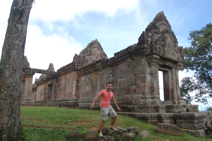
When I found out that it was possible (albeit near-impossibility at that time) to visit this sacred temple on a day trip from Siem Reap in 2012, I immediately grabbed the opportunity to see it while it was then — once again — enjoying a short “time of peace”. For a very long time in the past, as a disputed territory, the promontory of the Temple of Preah Vihear and its environs have had some serious history of crossfires between the Cambodian and Thai military forces. In fact, a few months prior to my visit, several soldiers from both camps were killed in an unexpected clash.

DSC_0218

The iconic first gopura, which contains some of the most impressive carvings in the temple complex.

Three years after that brave trip, as I look back, it is still perhaps the single most unique experience I have had in visiting a UNESCO World Heritage Site. Back then, it took me nearly four hours on a private vehicle to reach the temple from Siem Reap. Given recent road constructions, the travel time is now reduced to nearly half of what it took when I went there.

DSC_0335

The second gopura: the carving style of the pediment is different from the first one.

The Temple of Preah Vihear never failed my towering expectations, to say the least. After all, it was confidently inscribed on only one criterium: “(i) as a masterpiece of human creative genius”. So far, only this temple, the Taj Mahal, and the Sydney Opera House are inscribed solely on this basis.

The third gopura as seen from the elevated fourth gopura that encases the main sanctuary of the Preah Vihear Temple.

The third gopura: the walkway leading to the fourth gopura prior to the main central sanctuary is dotted with lingams. One lingam near the portal can be seen in this photo.

In my opinion, the temple rightly deserves to be on the same ranks as Angkor Wat and Bayon, if not even better. The incomparable beauty of this site stems from the following:

1. its history – older than those in Angkor, dedicated to Shiva and, according to some sources, is also one of a few that has a history of critical lingam worshiping;

2. its location – situated right beside a cliff, on top of the Dangrek Mountains to a height of nearly 600 metres. From the temple, one can already gaze at the Golden Triangle, an area shared by Cambodia, Thailand, and Laos;

The Infamous Golden Triangle: transnational boundaries of Cambodia, Thailand, and Laos.

The Golden Triangle

3. its relevance – a major pilgrimage site for Khmer kings, as well as a rare key temple off-route the Angkorian Royal Road;

4. its architecture – the extensive 800m-long layout of the temple is unique, the galleries surrounding the central sanctuary served as inspiration for the arrangement of Angkor Wat 300 years later, and the carvings offer a different style from those in Angkor (notice the style of its nagas, and the impressive quality of its carvings can only be compared to those of the much younger Banteay Srei); and, lastly,

5. the geopolitical struggles and controversies associated with its WHS-inscription in 2008, and the earlier landmark International Court of Justice (ICJ) ruling in 1962. More recently, in 2013, another ICJ ruling finally awarded the contested peripheral forest zone of the temple to Cambodia, putting an end to the long-standing dispute between the two Southeast Asian kingdoms.

DSC_0172

As a military zone, several soldiers are stationed in and around the temple complex. A political statement such as that in the photo clearly asserts Cambodian ownership over the promontory and its immediate vicinity.

As the Temple of Preah Vihear lies in an active military zone, it comes, then, as no surprise that not many travelers take the effort in seeing this site when I made my visit. In the five pleasurable hours that I spent there, I only managed to see about three other civilians — who might just be even locals — in the temple complex.

The central sanctuary guarded by a military personnel

The central sanctuary that is guarded by chanting monks. Outside, a soldier is also on guard.

Aside from the breathtaking view from the top, I truly enjoyed receiving blessings by chanting monks guarding the central sanctuary; as well as exploring the interior of the largely ignored vegetated Tower of the Long-haired Lady that is reminiscent of Ta Prohm in Angkor.

DSC_0389

The tower of the long-haired lady, an isolated structure that has been overgrown by plants and a tree.

Clearly, I got the strong impression that the Khmer people are indeed proud of the Temple of Preah Vihear as suggested by the displaying of the flags of UNESCO, Cambodia, and the World Heritage Committee not far from the first gopura. Such subtle declarations never fail to get noticed.

The temple of Preah Vihear together with its brother temple atop Phnom Chisor in the province of Takeo, which I also got the chance of visiting back in 2010, will always have special places in my heart for the wonderful experiences they have left me. In sum, the Temple of Preah Vihear clearly and easily justified itself as being one of the best single sites I have seen so far.

Just behind the temple: one simple mistake and I am history. The cliff drops to a height of 600 metres.

A view of the plains of the Preah Vihear province. This was taken at the edge of the Dangrek Mountain cliff.

There is no entrance fee to the temple. But, at the base camp, visitors have to pay for the motorbike that will transport them to the top for a fairly reasonable price. On this trip, I also went to the nearby town of Anlong Veng, visiting some ‘Khmer Rouge’ related sites such as the house of Ta Mok and the final resting place of Pol Pot.

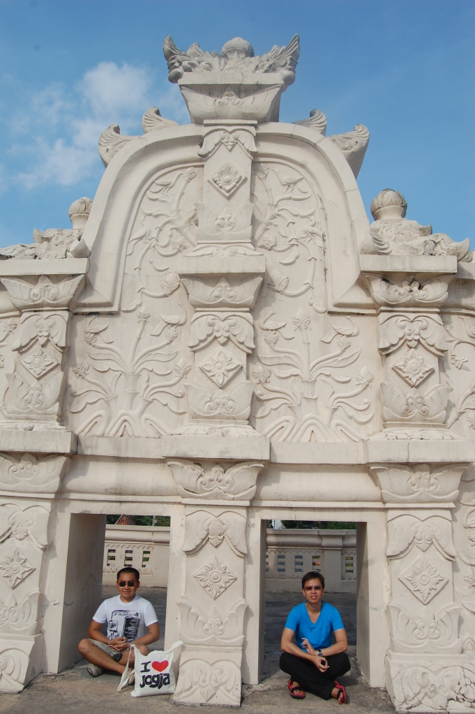
Jogjakarta in Hindsight

Standard

“It’s Jogja not Yogya!”, I’ve been corrected a hundred of times.

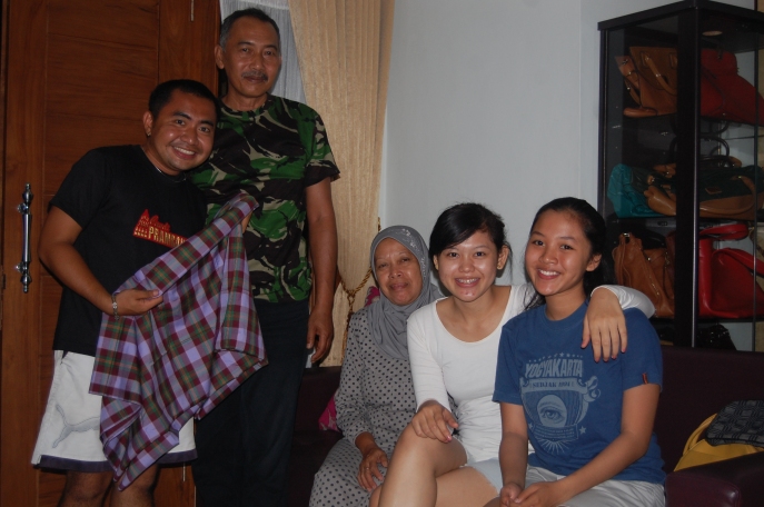
All throughout my stay in Central Java in 2013, I was at the receiving end of the generosity and kindness of Krido and his family. They did not only open their warm home to me, but they also took their precious time in bringing me to the best places there are in the area and endlessly feeding me with the delicious nasi gudeg and different varieties of sambal sauce to pair.

I used this colourful and historic city as my base in exploring three UNESCO World Heritage Sites nearby, namely: Borobudur, Prambanan (together with the Rotu Boko ruins), and Sangiran Early Man Site. The photos in this post, however, are those from Jogjakarta itself.

DSC_1215

The historic Tugu Jogja, the most representative landmark of Jogjakarta

DSC_1232

The Dutch-built Fort Vredeburg and its front moat. The fort was meant to intimidate the then reigning sultanate of Jogjakarta, hence it was constructed right in front of one of the royal palaces (locally called kraton) of the city.

DSC_1272

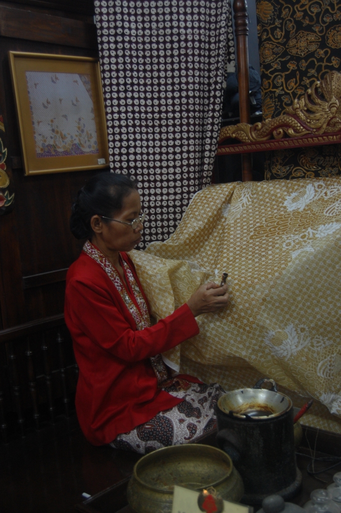
Mirota Batik is a specialty shop along Malioboro Street, the main thoroughfare of the city. One of the highlights of this boutique is the live demonstration of batik-making. Indonesian batik is in the register of Masterpieces of Oral and Intangible Heritage of Humanity.

DSC_1280

A wonderful artwork standing at the heart of Jogjakarta. The city center still has a lot of Dutch colonial-era buildings to boast.

DSC_1340

the corridors of the Sumur Gumuling, the eccentric underground mosque inside the Kraton Jogjakarta complex.

DSC_1317

The circular well with five staircases at the center of the underground mosque is considered to be a unique architectural feature of the Sumur Gumuling.

DSC_1289

Modernity and Antiquity: inside Kampung Taman, the village adjacent to the kraton complex.

DSC_1297

Taking a break from the hot weather outside: in an artsy nook in Kampung Taman.

DSC_1402

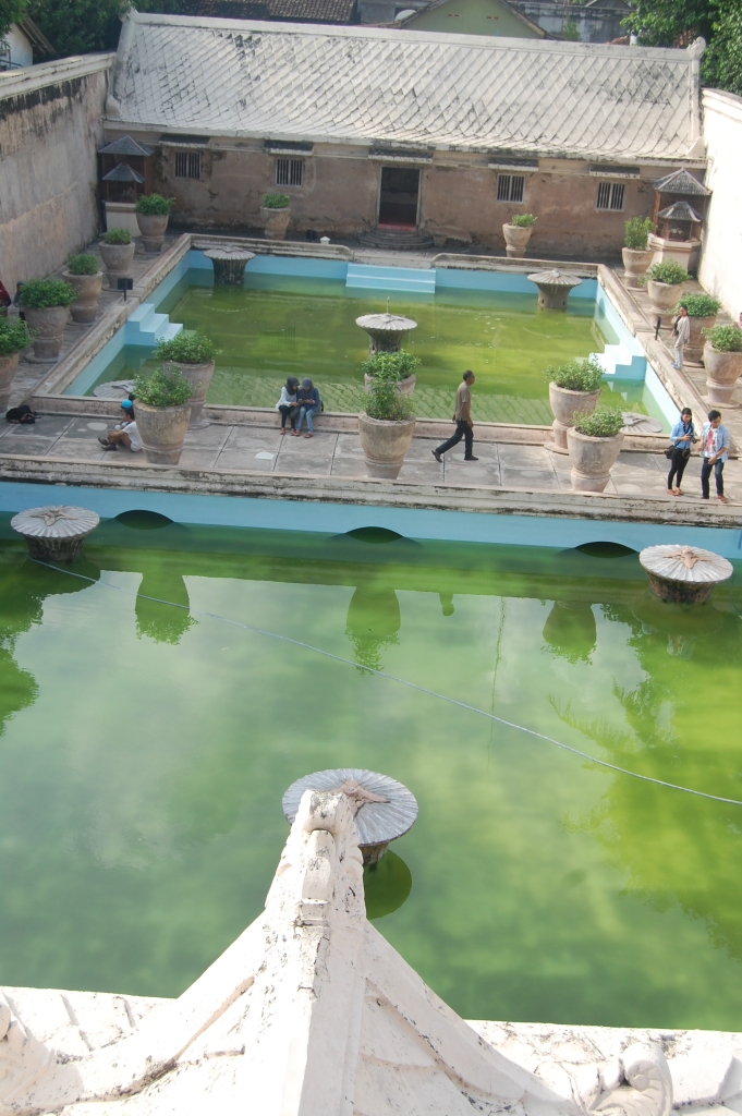
Taman Sari, known to the Dutch as the “Waterkasteel”, used to be the royal bath of the Jogjakarta sultan’s family.

DSC_1424

On top of the central tower of the Taman Sari is the former private chamber of the sultan. From here, would have been able to see everything that was happening inside the bath.

DSC_1386

The stylized gable of the front gate of the Taman Sari.

DSC_1460

One of the best hangout corners in town: Kalimilk, a truly Jogjakarta brand. Durian milkshake – checked.

DSC_1466

We traveled more than thirty minutes out of the city (at 11pm!) to go to this eatery (locally called warung). Krido and his cousins told me that this one is their favourite.

DSC_1187

Aunt Willy, my “supermom” in Jogjakarta. I felt so safe knowing that I was with her! 🙂

DSC_1955

Krido’s mom and dad, who were also in town when I was there, gave me this traditional Indonesian sarong that is typical from their hometown in the Dieng Plateau.

To Krido – I appreciate the gift of friendship. Ours is indeed another proof that it is possible to cultivate deep and meaningful connections from online platforms such as Instagram. Thank you for being with me from my arrival at the Jogja airport, to the magnificent temples and far-flung dig sites we visited, until my day of departure up in Semarang!

Three years and counting 🙂

Abra in Colours: The Tingguians, Bamboos, and the Art of Dyeing

Standard

Abra is a province in the Cordillera Administrative Region (CAR) that is notorious for its records of election-related violence more than any other thing. Development is slow in this province and not much is really happening inside. It is, therefore, not at all surprising that this place is not one of those that would be in your priority of places to see in the Philippines: to mention that you are going to Abra to other Filipinos will surely invite some stare of judgment and even dissent.

What led us to Abra in July 2013 is to feature its “natural dye makers” — the indigenous highland people called Tingguians — for What I See travel photography show.

IMG_20130721_092116_1

The view of Bangued, the capital town of Abra, from the top of the Cassamata Hill National Park.

Right after the storm: International photographer Francisco "Paco" Guerrero scouting the surroundings of the long Calaba Bridge for the best capture there is to find.

Right after the storm: International photographer Francisco “Paco” Guerrero, the host of What I See, scouting the surroundings of the Calaba Bridge and the river basin for the best capture there is to find.

The Bamboo Split Weavers

The Tingguians, also called Isneg, are engaged in various crafts. The most important of which is bamboo crafts production. It is for this reason that Abra is aggressively positioning itself as the “Bamboo Capital of the Philippines”.

IMG_20130719_102505_1

IMG_20130719_102547_1

IMG_20130719_102345_1_1

The Natural Dye Makers

In documenting the production of natural dyes from plants, the team went to the Tingguian village of Namarabar in Penarubia, a town an hour away from the capital Bangued.

Norma Agaid, a Tingguian elder and the sister of the “Father of Philippine Natural Dyes” Luis Agaid, explained which plants yield what kinds of colours: mahogany for red, jackfruit and ginger for yellow, the malatayum plant for indigo, the narra tree for brown, among others.

Of all the mountain tribes in the Philippines, we have the most number of colours. We only get these colours from sources present around us“, she proudly shared.

IMG_20130720_105818_1

A local icon: Norma Agaid sporting an authentic Tingguian attire. Notice the “frog” pattern in her skirt. Traditionally, this is worn during the rainy months in the belief that this will please the gods and their ancestors in giving them the best out of the planting season.

IMG_20130720_120317_1

the malatayum plant produces the colour indigo that will later be used in dyeing textiles with various shades of blue.

IMG_20130720_120340_1

Brewing narra barks in this earthenware produces the colour brown sap. The narra is the national tree of the Philippines.

IMG_20130720_103236_1

The Tingguian women — in their native backstrap-woven clothes — preparing to serenade the What I See team with a traditional welcome song that they composed only a few minutes before we arrived.

The charm of Abra stems from the fact that it is not at all in the tourism map. Indeed, it is highly ignored by outsiders. Hence, our experience in this rustic province can only be as natural and authentic as we can get. Indigenous dyeing is obviously a dying art. It is important to shed light into it as it is a part of the bigger “Filipino identity and local artistry” that most of us Filipinos tend to take for granted.

DSC_1289_1_1

Tingguian designs are largely linear and simple, but are assigned with many meanings. Some textiles are reserved for use only during special occasions such as birth-giving, nuptials, and harvesting. The vividness of colours in this shroud only suggests the level of mastery they have in controlling the strength of the dyes they make from readily available sources around them.

Paco Guerrero, whose background is no less than Anthropology, could not have described the Tingguians any better, “In the forest, they do not only see trees and plants. They see colours.”

The Philippines through the Hands of Ten Filipinos

Standard
IMG_1916

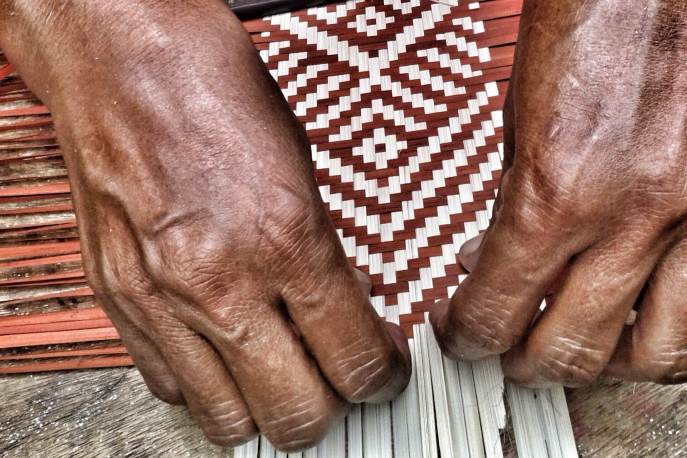
A Tingguian bamboo split weaver in the province of Abra in the Cordillera Administrative Region. The Tingguian people, also known as Isneg, are a lowland indigenous people group that traces their ancestry to the much older Itneg group of the highlands.

IMG_1907

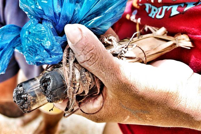
Hand of a Tagbanua bird’s nest (an expensive ingredient for an exotic soup) hunter holding a locally-prepared torch used to lighten up the deepest parts of the caves in Coron Island of Palawan. Gathering bird’s nest is known to be one of the most dangerous jobs in the world. The Tagbanua people are sea-dwellers and are some of the first to occupy the archipelago.

IMG_1909

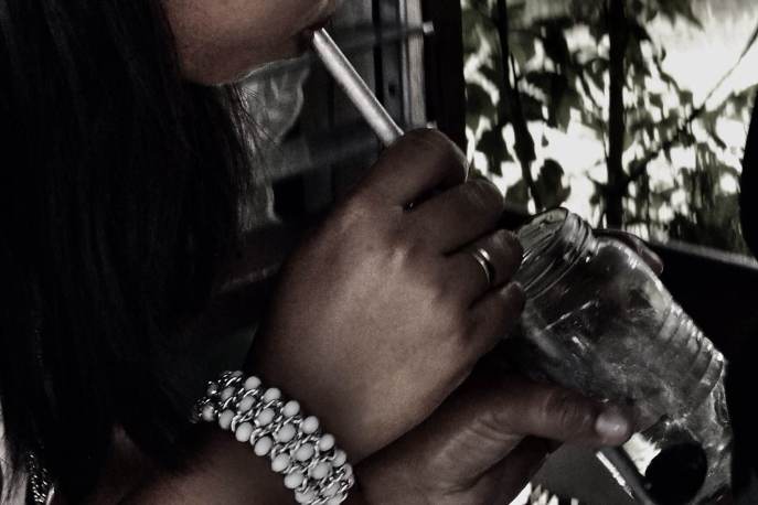
A traditional healer performing “bulo-bulo” (a form of cleansing done by blowing a water-filled glass containing an amulet) to a curious patient in Siquijor. Sometimes, just right after the ritual, foreign objects — such as sand, pebbles, and even worms — emerge inside the glass! This small island is notorious for its history of sorcery, witchcraft and the dark arts.

IMG_1919

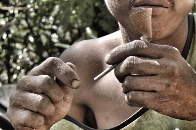
A Taubuid Mangyan showing a pipe he made using a bamboo twig and clay with some tribal etchings. These people inhabit the central parts of Mts. Iglit-Baco National Park, and are some of the oldest known groups in the Philippines. They have an ancient writing system identified as a paleograph and is registered in the Memory of the World list.

IMG_1915

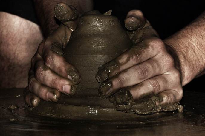
A local potter in the “Pagburnayan” village in the historic town of Vigan, a World Heritage Site. Pottery was introduced by Chinese merchant-craftsmen who have been trading with earlier Filipinos since time immemorial. The Pagburnayan village is home to one of the longest extant dragon kilns outside mainland China.

IMG_1908

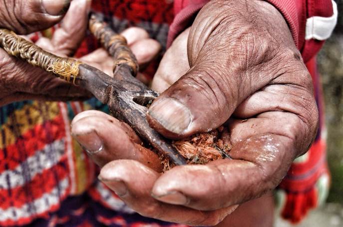
An Ifugao preparing a “moma”, a bettelnut chew in Banaue. The Ifugao are the same people who constructed the world-famous rice terraces of the Philippine Cordilleras (a World Heritage Site), and are, likewise, the guardians of the “Hudhud” chants (a Masterpiece of Oral and Intangible Heritage of Humanity).

IMG_1906

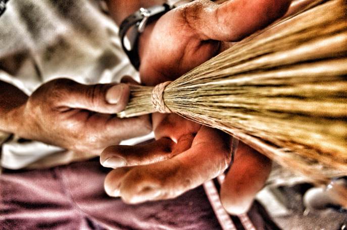
An Iraya, a lowland Mangyan sub-group, making a broom out of tiger grasses in Tamisan, a village on the foot of Mts. Iglit-Baco National Park, an ASEAN Heritage Park. Even with extensive and heavy use, these local brooms are known to last for years.

IMG_1922

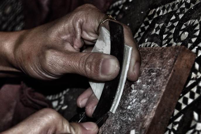
Hands of a Maranao woman inlaying mother of pearls to a wooden chest. The Maranao people of Tugaya beside Lake Lanao are some of the most artistic groups in the Philippines. Nearly all households in town are engaged in various traditional ‘okir’-based crafts such as wood carving, weaving, brass-ware making, among others.

IMG_1918

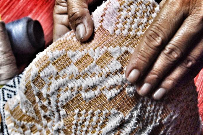
An Ilocano showing an heirloom “abel” textile from Paoay in Ilocos Norte. The half century-old textile featured in this photo follows the “sinukitan” technique. Abel are loom-woven textiles that are known for their versatility, sturdiness and creative patterns, as well as the critical role they played during the galleon trade years with Mexico and Spain.

IMG_1920

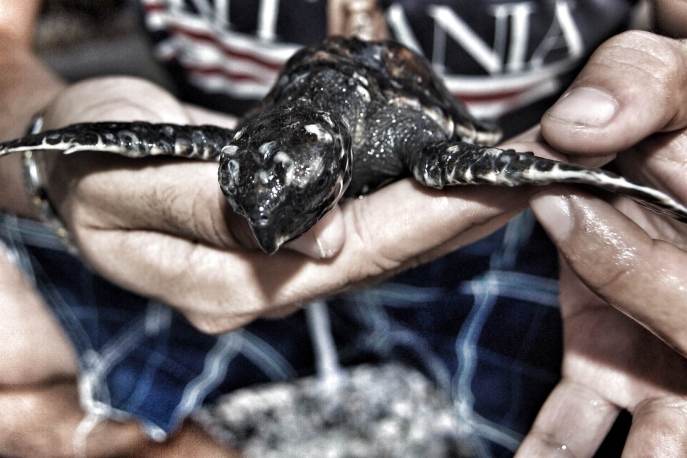
A Tagalog tourist holding a newly hatched Hawksbill turtle in Puerto Galera, a declared World Biosphere Reserve. The Philippines is recognized by the scientific community as the center of the famed Coral Triangle, a region home to the highest concentration of marine biodiversity in the world.

A Pilgrim’s Progress: Our Lady of Caysasay

Standard

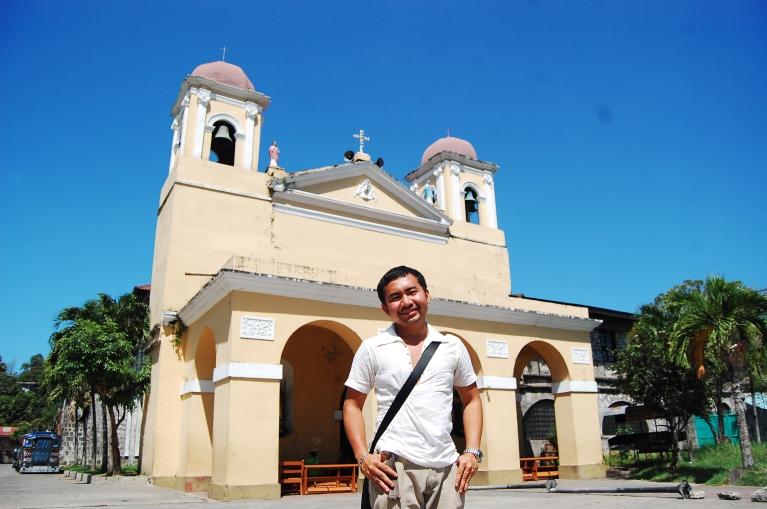
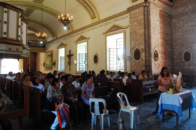
A rare opportunity to have a photo taken of an all-women devotees presented itself. The photo below was taken from the back of the Nuestra Señora de Caysasay, a Marian image canonically crowned by virtue of a Holy See approval in 1954.

image

Though I cannot come up with anything conclusive as to what the ongoing activity might have been then, the fact that the service was only attended by women made me feel alienated, and a bit awkward about my presence inside the shrine when things were unfolding. If any, however, despite my unconventional stance on religion, one cannot deny the experience and fulfillment in capturing religion in action as a material culture here.

DSC_0512 DSC_0516DSC_0546

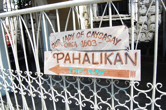
Pilgrims to the Shrine of Our Lady of Caysasay in Taal, Batangas may receive the plenary indulgence that is granted to those who visit the ancient church of Sta. Maria Maggiore in Rome.

DSC_0545

The old town of Taal is one of the only four heritage towns in the Philippines — together with Vigan in Ilocos Sur, Pila in Laguna, and Silay in Negros Occidental — designated as National Historic Landmarks by the National Historical Institute of the Philippines.

DSC_0329 DSC_0868