The Philippines has a rich history and culture, but we sometimes do not understand the country well enough to realize to what extent. It is not a question of whether we have it or not. Rather, it is of how much we really know and are aware. One way to get reacquainted with the Filipino identity and our past is by taking what I would call as a heritage trail up north. The beauty of Northern Philippines lies on the fact that it is home to four UNESCO World Cultural Heritage Sites.
What does this mean?
A UNESCO World Heritage Site (WHS) is any given natural or cultural place, monument or landscape that holds outstanding universal values critical to the development of humanity, and which reflect diversity. Some of the more popular WHS around the world include the Great Wall of China, the Stonehenge, the Taj Mahal, Chitchen Itza, the Table Mountain, the Great Barrier Reefs, and even the Statue of Liberty. Regardless of popularity and fame, however, all of these places are treated with equal degree of cultural and historical importance.
With the recent addition of Mt. Hamiguitan Range Wildlife Sanctuary in Mindanao in 2014, the Philippines now has six sites listed as WHS. Two of which are marine natural sites in Palawan, the Puerto Princesa Subterranean River National Park and Tubattaha Reefs Marine Park. Both of these sites are also declared as Ramsar wetlands of international importance. The other three are cultural sites found in Northern Philippines: the Rice Terraces of the Philippine Cordilleras, the Historic Town of Vigan, and the Baroque Churches of the Philippines.
From Manila — where San Agustin church, another WHS, is found inside Intramuros — one can make a Do-It-Yourself trip in taking on this heritage trail. A bus from Manila can take you to Banaue, the jump-off point for the rice terraces. From there, vans can be arranged to bring you down to Vigan. Sta. Maria is also along the way to Vigan, and finally, going further north by bus will bring you to Paoay in Ilocos Norte. Each place offers a taste of the depth of Philippine history and Filipino ingenuity.
Rice Terraces of the Philippine Cordilleras
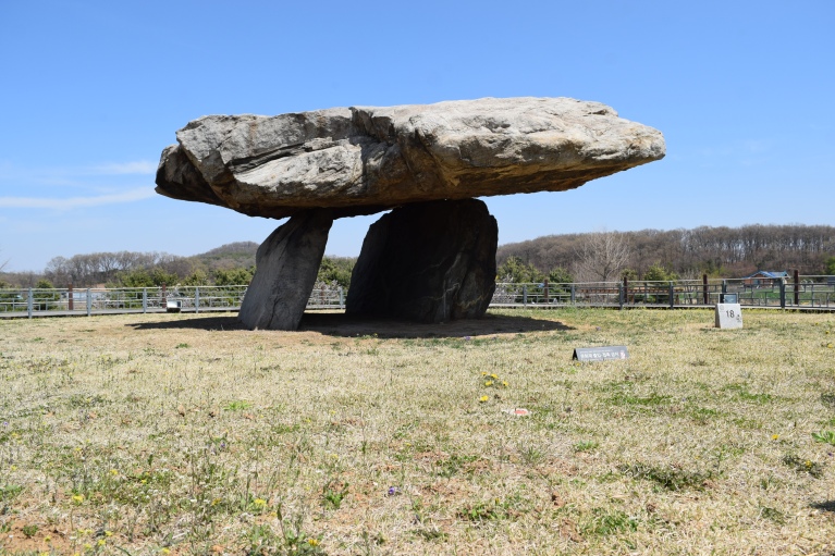
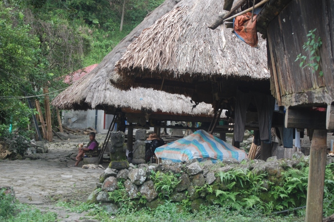
Agricultural terracing is not unique to the Philippines. China, Indonesia, and Viet Nam have it. Peru and even Switzerland have this method, too. What makes the rice terraces in the Philippines unique is that they are the oldest and most extensive continually-used rice terraces in the world. As a comparison, these rice terraces have been around much longer than Machu Picchu or Angkor have! The more noticeable distinguishing marks of these engineering marvels would be their heights that reach as high as 1,500 metres from the base, and their steepness that defies limits with 70 degrees maximum angulation.
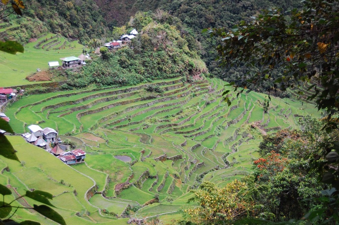
The incredible mixture of purely man-made terraces, the mountains, the muyongs (forest caps), traditional hamlets, and other visible cultural artifacts in the region certainly does not disappoint. The Food and Agriculture Organization has cited the rice terraces as an outstanding example of “worldwide, specific agricultural systems and landscapes (that) have been created, shaped and maintained by generations of farmers and herders based on diverse natural resources, using locally adapted management practices.” The American Society of Civil Engineers also named the rice terraces as a ‘Historic Engineering Landmark’ for water supply and control. In 1997, the same group came to the Philippines and formally declared (through a marker) the rice terraces as the [original] 8th Wonder of the World.
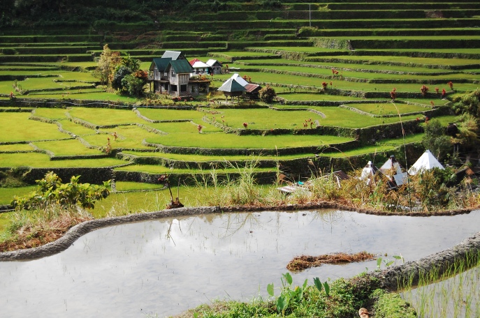
For the Filipinos, with the mode of farming and the people’s lifestyles largely unchanged, these ancient rice terraces are an enduring portrait of the ways of life of the Ifugao for over 2,000 years. The WHS-listed clusters are Batad, Bangaan, Hungduan, Mayoyao and Nagacadan rice terraces. Hungduan is also one rare site in the world as it is home to no just one but two UNESCO Masterpieces of Oral and Intangible Heritage of Humanity, the Hudhud chants and the Punnuk.
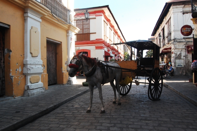
Historic Town of Vigan
Why does this small town merit a special place in the collective memory of the Filipino people? It is one of the few towns in the country that was spared from destruction during the World War II (Intramuros, Manila’s walled district, was razed to the ground and only one building was left standing there after the war). Being the best preserved Spanish colonial-era trading town in Asia, Vigan presents itself as an intact and authentic old town. It boasts a good collection of original houses wherein the ground floors are characterized as Hispanic, while its upper floors and windows suggest Chinese and Oriental influences. The best of these houses can be seen along Calle Crisologo, a re-created cobblestone street.
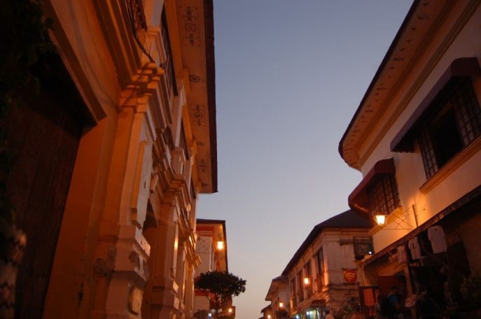
One will notice that the town faithfully follows the historical “quadricula” or “grid” street plan. This, believe it or not, is the most ‘Hispanic’ feature of the town. The interior of a typical Vigan villa can be seen when visiting the likes of the Sy-Quia mansion, the family house of the former President Quirino.
In 2012, Vigan bagged the ‘Best Management Practices for a World Heritage City’ award in a worldwide competition by UNESCO. And again, three years later, Vigan was voted as one of the Seven New Wonder Cities in the World through a global online poll.
Baroque Churches of the Philippines: Sta. Maria
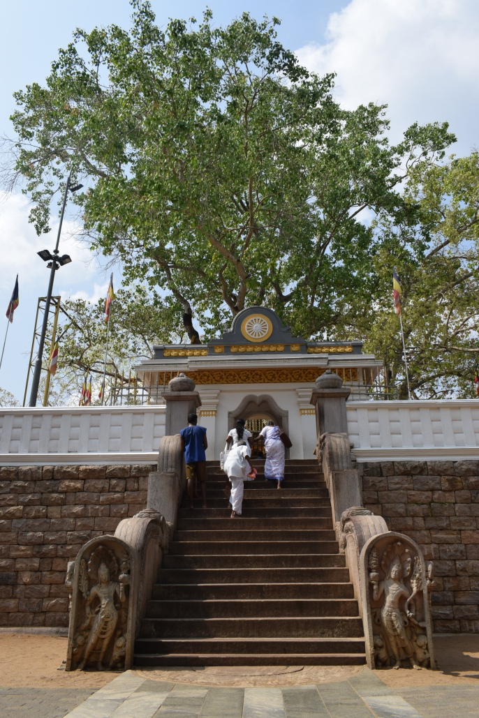
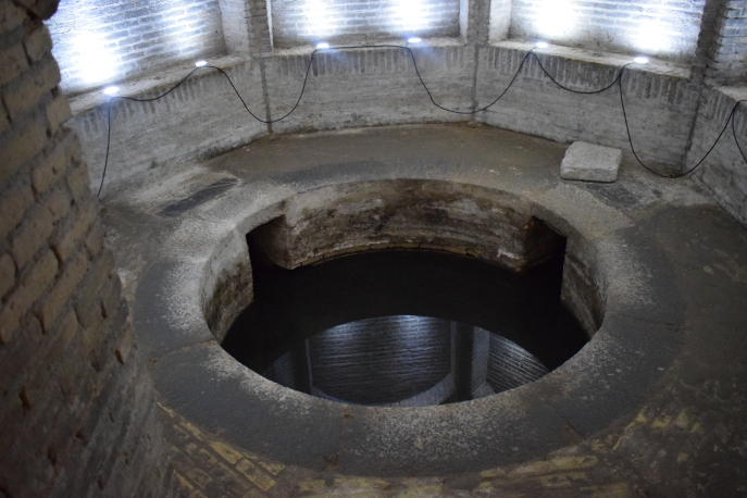
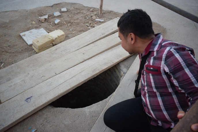
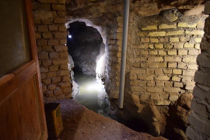
Aside from the San Agustin church inside Intramuros and the Miag-ao church in Iloilo, the Northern Philippines boasts two of the best examples of Philippine Spanish-era churches. The town of Sta. Maria, some 40 minutes south of Vigan, houses a citadel church built on top of a fortified man-made hill. In the older days, the only way to reach the church is through the 82-step staircase made of granite slabs, making the complex easily defended.
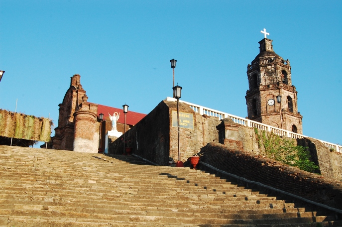
Made of red bricks, the Asuncion de la Sta. Maria church boasts a set of massive buttresses that supports the structure from the damages of earthquakes. The pagoda-shaped bell tower is leaning due to the collapsing retaining walls around the hill, which placed this church in the ’100 Most Endangered Sites’ in 2010 by the World Monument Watch of the World Monument Fund.
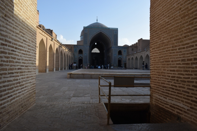
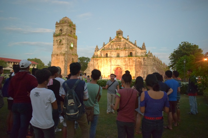
Baroque Churches of the Philippines: Paoay
The crowning gem of the “earthquake baroque architecture” is the San Agustin church in Paoay. This edifice is largely made of coral stones that have been glued together using egg whites, lime powder and molasses. This important church features a mixture of Oriental, Malay, and Western influences in its design. This comes as no surprise as long before the Spaniards reached present-day Paoay, the site was already a trading settlement known as Bombay in earlier records.
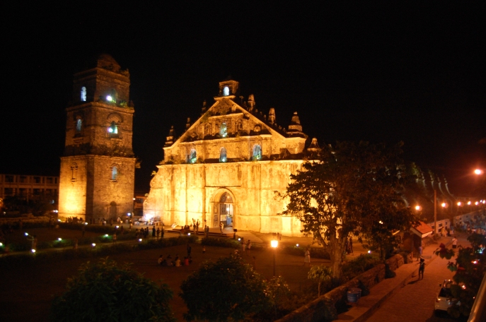
Keen eyes will notice some fading carvings and bas-reliefs around the church. The most important exponents of this church are definitely its beautifully-constructed massive buttresses. Paoay church is considered to be a masterpiece of the Filipino reinterpretation of the baroque movement, fusing European principles with local Filipino craftsmanship. The bell tower is also separated from the church as a precautionary measure against the effects of earthquakes – this architectural innovation is unique to Philippine churches.
The churches of the Philippines are unique, and, thus, cannot be compared to those found in Europe or Latin America. As religious monuments, they are key in spreading further the Christian faith in the region (Southeast and East Asia, and the Pacific Islands). While as cultural specimens, they embody the artistic, technological, and intellectual interchange between the West and the East for more than three centuries.
While knowing and understanding Philippine history and culture is a large part of what I do as a heritage advocate, the biggest challenge is in making others see and appreciate things the way I do.
I often have a hard time convincing friends who have already settled abroad to come back home to re-experience their native land. Most of them would rather spend their vacations going around Europe or elsewhere in Asia to see cultural and grand ancient monuments or old towns, believing none exist here.